Our visual (RGB) service lines include:

3D Modelling
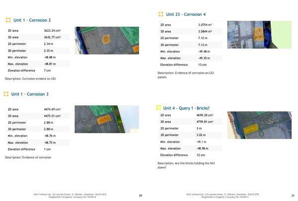
3D models and digital twins give you a powerful, interactive view of your area of interest—far beyond what photos alone can show.
No guesswork. No repeated site visits. Just accurate, actionable data.
- Spot Issues Instantly - Zoom, rotate, and inspect every detail from any angle—without stepping foot on a ladder, or MWEP. Ideal for identifying damage, wear, or potential leaks on your site.
- Measure Without Climbing - Take precise measurements directly from the model—ideal for quoting, planning repairs, or installing solar systems.
- Document Everything - Create a timestamped, shareable schedule of condition—essential for pre-lease surveys, dilapidations, insurance claims, compliance, or contractor accountability.
- Save Time & Money - No scaffolding. No repeated visits. Share the digital twin with your team, client, contractor or insurer and make decisions faster—with full clarity.
High-Resolution 2D Orthomosaics
Our 2D orthomosaics give you a complete, top-down view of your entire site—accurate, detailed, and ready to measure.
- One Image, Total Clarity - No more scrolling through dozens of photos. See every ridge, seam, tile, and fault in a single, high-resolution map you can zoom, annotate, and share.
- Measure with Confidence - Take precise, real-world measurements—perfect for quoting repairs, planning installations, or managing contractors.
- Professional Reporting - Whether it’s for insurance, compliance, contractor negotiations or a client - a clean, accurate orthomosaic adds instant transparency to your inspection needs.
- Efficient - No need for repeat visits or site access—just share the image and collaborate from anywhere with your team.
Annotated Site Reports
Our annotated inspection reports combine crystal-clear aerial imagery with notes, so you know exactly what’s happening and are empowered to make informed decisions.
- See It. Understand It. Act on It - We pinpoint defects, damage, and areas of concern, directly on the image, with clear, jargon-free notes.
- Shareable and Professional - Send the report to your contractor, insurer, or client. Everyone sees the same data, clearly explained.
- Document - Need evidence for insurance, compliance, or warranties? Our timestamped, annotated reports give you clear documentation to facilitate your needs.
Applications
Utilise our Visual Service Lines across a range of applications, such as;
- Scheduled reports
- Planned maintenance reports
- Pre-lease inspections & Dilapidations – Enable visual monitoring of progressive degradation
- Schedule of conditions of any elevation
- On site stockpile volume measurement
- Development monitoring - Progressive site monitoring
- Facade inspections
- Measured surveys